Live US wildfire data, updated every few minutes
Next-Gen Wildfire Alerts and Professional Crew Tools
Live monitoring of every fire on the map. Next-Gen Crew tools for wildland fire professionals. Lightweight tools for the people on the line: SpikeMaps, our 3D tactical maps that work offline, integrated Crew and Fleet tracking, emergency alerts, Incident briefings, integrated comms, meshnet connectivity and more.
Get the free Daily Fire Digest · See plans and pricing
The map is free, no account needed.
Supplemental, not an evacuation order. Verify with local officials.
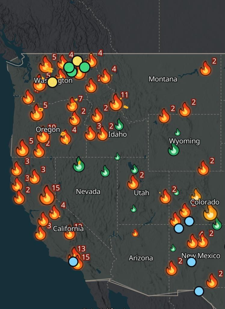
Live US fires, updated every few minutes
Next Gen WildfireAlerts & Crew Tools
Welcome to SpikeCamp! How Can We Help?
The map is free. No account needed.
Where should we watch?
Pick your home, cabin or town. You'll hear about fires and evacuation orders near it.
In the app this asks your phone once, to find the place. SpikeCamp doesn't track you.
No problem. You can turn alerts on later in Alerts.
Set up for the line
SpikeCamp works for you all year, on a crew or not. Joining an incident is only for when you're assigned.
Run your incident
Every crew on one board. Put the join QR up at briefing and they're live in seconds.
- 1Open an incident and name it
- 2Show the join QR at briefing
- 3Watch the board fill in
Command seats are free. Opening an incident needs the Crew Lead plan.
Allow SpikeCamp to send you notifications?
Tap through it: the first screens of the app, on the web and Android. A preview, nothing is saved.
The Daily Fire Digest, free
Every morning: fires within 50 miles of your town, evacuation orders, power shutoffs and air quality. One email, and a short one on quiet days.
- NIFC WFIGS incidents and perimeters
- 119 wildland dispatch centers (WildCAD-E new starts)
- NASA FIRMS satellite hotspots
- EPA AirNow air quality
- NOAA HMS smoke
- National Weather Service Red Flag warnings
- FAA fire TFRs
- ADS-B aircraft
- County evacuation zones
- FEMA open shelters
- USGS terrain
- OpenStreetMap roads
Early Access pricing
Pro: Fire Watch, for homeowners, is $4.99/month or $39/year. Pro: Fire Crew, for firefighters, is $10/month or $80/year. Pro: Fire Crew Lead is from $75/month by crew size, up to 50 people. Command seats are free. Safety alerts stay free.
Early Access SpikeCamp is in Early Access. New tools ship every week, what crews tell us shapes what comes next, and these are Early Access prices.
Safety info is always free. Billed monthly or yearly. Cancel anytime.
Free
$0
Safety info is always free.
- National fire map
- A page for each fire
- Evacuation zones stay free
- Share any fire page
- Watch one place free
- Fire aircraft near active fires
- Power shutoff alerts
- The Daily Fire Digest
Most popular
Pro: Fire Watch
$4.99/mo
or $39/year (save 35%). For homeowners.
Everything in Free, plus:
- Watch 10 places
- Your home on your map
- Follow 25 fires
- Share with your household
- Wind and ember outlook
- “Heading your way” alerts
- Smoke alerts at your level
- Road closure alerts
- The full Daily Fire Digest
- Fire history near you
- Aircraft trails on the map
Pro: Fire Crew
$10/mo
or $80/year (save 33%). For firefighters.
Everything in Fire Watch, plus:
- Wind and weather layers
- Pins with photos
- One link for family
- Extra offline map areas (coming soon)
- SpikeMaps: live tactical maps
- GPS on SpikeMaps
- Optional: import a GeoPDF
- Meshtastic position relay
- Heart-rate strap and manual log
- Personal time report
Pro: Fire Crew Lead
from $75/month
By crew size, up to 50 people. Command seats are free.
Everything in Fire Crew, plus:
- Crews on your TAK map
- Crew time and roster exports (coming soon)
Pro: Fire Crew Lead is priced by crew size, per month: up to 5 people $75, up to 10 $150, up to 20 $250, up to 50 $400. Pay yearly and get 2 months free. Size is the people on your crews and open incidents. You and command seats don’t count. Over 50? Contact us. Annual agency licenses are available. Meshtastic relay is live. How crew tracking works.
Start Fire Crew LeadWhat you get
For everyone
Safety information stays free. Always.
For crews and incident command
Built for the Fire Line
The operating system for wildland fire, designed around what goes wrong: no signal, dead phones, heavy files, and the fog of war.
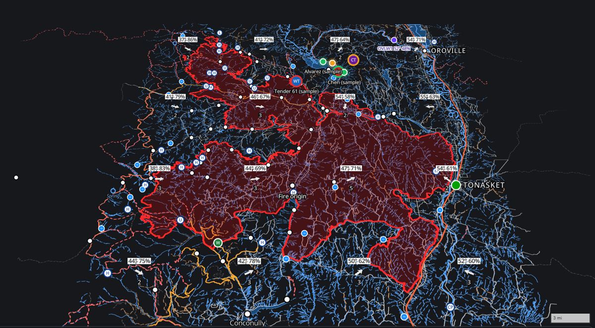
Lightweight, 3D tactical maps that work offline
Perimeter, roads, drop points and terrain, saved to your phone before the signal goes.
Perimeter, roads, drop points, water, and terrain, packed small enough to save to a phone before you lose signal.
- Live individual and crew tracking
- SpikeMaps: tactical maps we auto-build for active fires
- Weather, aircraft, and TFR layers
- Tactical tools: layers, evac zones, drop pins, and more
Crew tracking that survives no signal
Positions wait on the phone and send the moment any link returns.
Crew members opt in for an assignment with a 6-character join code from their crew lead or command. Positions are recorded on command’s cadence and wait on the phone when there is no link, then send the moment one returns. Command sees who has dropped off and where they were last.
- Rest, stop, and demob from the phone or from command
- Accuracy, battery, and link reported with every fix
- Data stays with the incident and is deleted on its schedule
- Native Android app in testing, with tracking that keeps going with the screen off; iPhone next
Emergency alerts, briefings, and messaging
Emergency button, daily briefings with acknowledgement, and crew channels.
Hold the emergency button and command gets a banner with your position and the link it came over. Command pushes the daily briefing and sees who has it and who acknowledged it. Crews, individuals, and command message each other, and messages wait for signal instead of failing.
- Acknowledgement tracking with one-tap reminders
- Crew channels, a private line to command, direct messages
- Messages are kept with the incident record and are not private
A command board that plugs into your COP
Live positions on topo or imagery, and into TAK, ArcGIS and Google Earth.
Live positions, trails, accuracy rings, and dropped-off status on topo or imagery, filtered by crew or resource type. Share a revocable read-only feed with the tools you already run, and replay any window from the last 14 days for an after-action review.
- Crews and SOS alerts on your TAK map: a push to your TAK Server or a one-tap data package (how it works)
- Cursor-on-Target for TAK and WFTAK
- KML for ATAK and Google Earth, GeoJSON for ArcGIS
- Audit log of joins, alerts, acknowledgements, and feeds
Gets better every shift
Automatic after-action findings, with ICS 214 and 211 ready to file.
SpikeCamp quietly keeps track of how the incident ran: who dropped off, how long alerts waited for an acknowledgement, which briefings didn’t land, who’s past 16 hours. Each operational period ends with an after-action report and plain-language findings, so the next shift starts a little sharper. No extra paperwork, no heavy downloads.
- Automatic after-action findings
- Response times, coverage gaps and work/rest flags
- ICS 214 and 211 ready to file
Run it on your next assignment
Open an incident, put the join QR up at morning briefing, and watch the board fill in. Agencies interested in a pilot can write to us.
See it in 10 seconds
Now live in early access, for individuals and crews.
How it connectsCell, Starlink, Meshtastic mesh radios, and into TAK and ArcGIS.
Phones report over cell or a crew’s Starlink hotspot. Meshtastic tags pass positions radio to radio to a gateway. It all lands on one command board and in your TAK or ArcGIS picture.
Why it exists
Built on the line, not in a boardroom.
Built in Washington, by a wildland fire crewman and former US Army Field Artillery Captain. The work started on the 2026 Sinlahekin Fire. Every feature starts from something that went wrong out there: lost crews, dead phones, heavy map files, and long stretches with no signal.
News
Latest from SpikeCamp
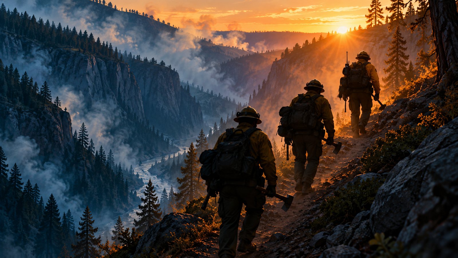 October 30, 2026SpikeCamp selected as FireWERX Dismounted Resource Tracking Challenge FinalistSpikeCamp is a finalist in the FireWERX Dismounted Resource Tracking Challenge. Challenge Day is December 15 and 16. Early Access subscriptions are open.
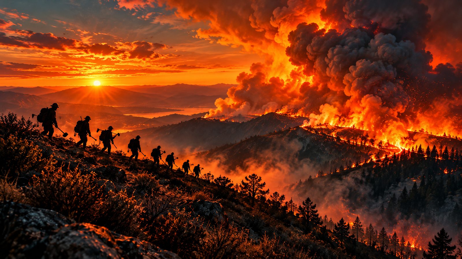 October 20, 2026We entered SpikeCamp in the FireWERX Dismounted Resource Tracking ChallengeSpikeCamp entered the FireWERX Dismounted Resource Tracking Challenge (host: Orange County Fire Authority). What we proposed and committed to.
Questions
Frequently asked
Is SpikeCamp free?
Yes. The fire map, fire pages, evacuation zones and one watched place are free, and safety information always stays free. Pro: Fire Watch, for homeowners, is $4.99/month or $39/year. Pro: Fire Crew, for firefighters, is $10/month or $80/year. Pro: Fire Crew Lead is from $75/month by crew size. Plans
Does it work without signal?
Yes. Saved maps work with no service. Crew positions wait on the phone and send the moment any link returns: cell, a Starlink Mini or a Meshtastic radio. Offline maps
Is SpikeCamp an official alert or evacuation service?
No. It gathers official sources, but it does not issue evacuation orders or dispatch help. Follow official orders, and call 911 in an emergency. Safety notice
How does crew tracking work?
A crew lead adds you by email or crew QR, or command puts an incident’s QR code up at briefing. You opt in and start tracking yourself. A code or QR from a paid crew or incident lets you join; otherwise it needs Pro: Fire Crew or an invite. Join a crew
Who can see my location?
Only Share with crew lets others see you. Record my track stays only on your phone, and Show me on map is only for you. With Share with crew on: on a crew with no incident, your crew and crew lead. On an incident, also command, your division if command sets it that way, and the feeds command shares with its common operating picture. The public map shows fires, never people. Who sees your GPS
How is Crew Lead billed?
Pro: Fire It’s priced by crew size, per month: up to 5 people $75, up to 10 $150, up to 20 $250, up to 50 $400. Pay yearly and get 2 months free. Size is the people on your crews and open incidents. You and command seats don’t count. Over 50? Contact us. Charged up front, monthly or yearly. Plans bought before November 6, 2026 keep their per-person billing until changed. How Crew Lead billing works
Is there an Android or iPhone app?
SpikeCamp runs in any phone browser today and installs to the home screen. A native Android app, with tracking that keeps going with the screen off, is in testing now; iPhone follows. Why a locked phone pauses GPS
How do I get help?
Browse the help articles, or use Report a problem in the app (More). Replies usually come from our AI support assistant, and a person is always one reply away. All help articles
Start free. Upgrade when you need it.
The fire map and safety alerts are free, no account needed. Pro and Crew Lead unlock when you're ready.