
SpikeCamp

Live US wildfire data, updated every few minutes

Every fire on the map. Every crew in reach.

A free live wildfire map for everyone, and an offline-first crew platform for the people on the line: tactical maps, crew tracking, emergency alerts, briefings, and messaging that keep working when the signal doesn’t.

The map is free, no account needed.

Supplemental, not an evacuation order. Verify with local officials.

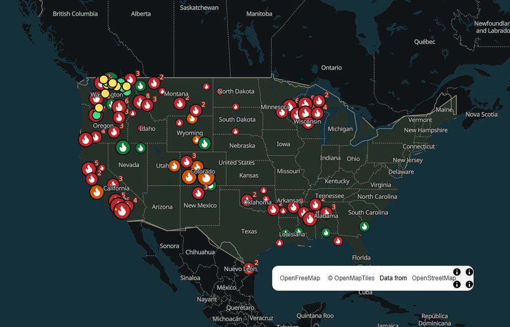
SpikeCamp national map with current US wildfires shown as flame markers
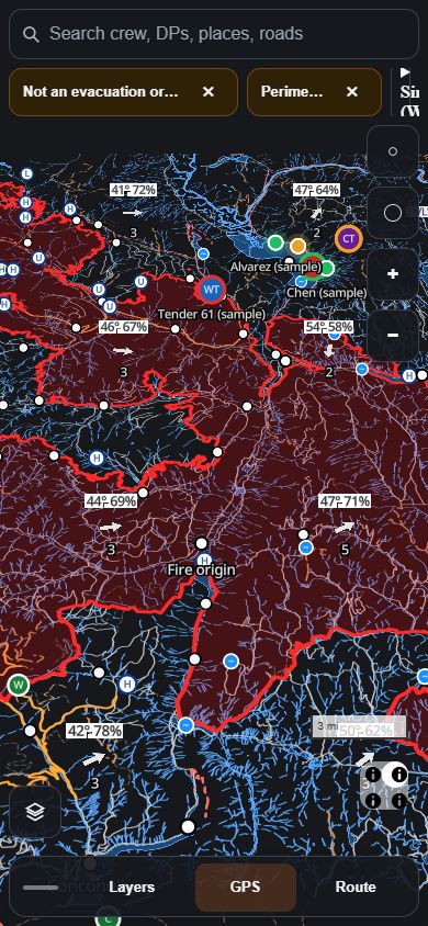
SpikeCamp tactical map on a phone: fire perimeter, roads, drop points, and crew positions
Live national map, and a tactical incident map on a phone (Sinlahekin sample pack).
Built on public data
  • NIFC WFIGS incidents and perimeters
  • WildCAD-E dispatch new starts
  • NASA FIRMS satellite hotspots
  • EPA AirNow air quality
  • NOAA HMS smoke
  • National Weather Service Red Flag warnings
  • FAA fire TFRs
  • ADS-B aircraft
  • County evacuation zones
  • FEMA open shelters
  • USGS terrain
  • OpenStreetMap roads

For everyone

Safety information stays free. Always.

For crews and incident command

Built for the people on the line.

Designed around what goes wrong on a division: no signal, dead phones, heavy files, and a command post that can’t see where everyone is.

Tactical maps that work offline

Perimeter, roads, drop points, water, and terrain, packed small enough to save to a phone before you lose signal. Your GPS dot keeps drawing with no service.

  • Incident packs, not whole-state downloads
  • Weather, aircraft, and TFR layers when a link is up
  • Land ownership colors on Crew
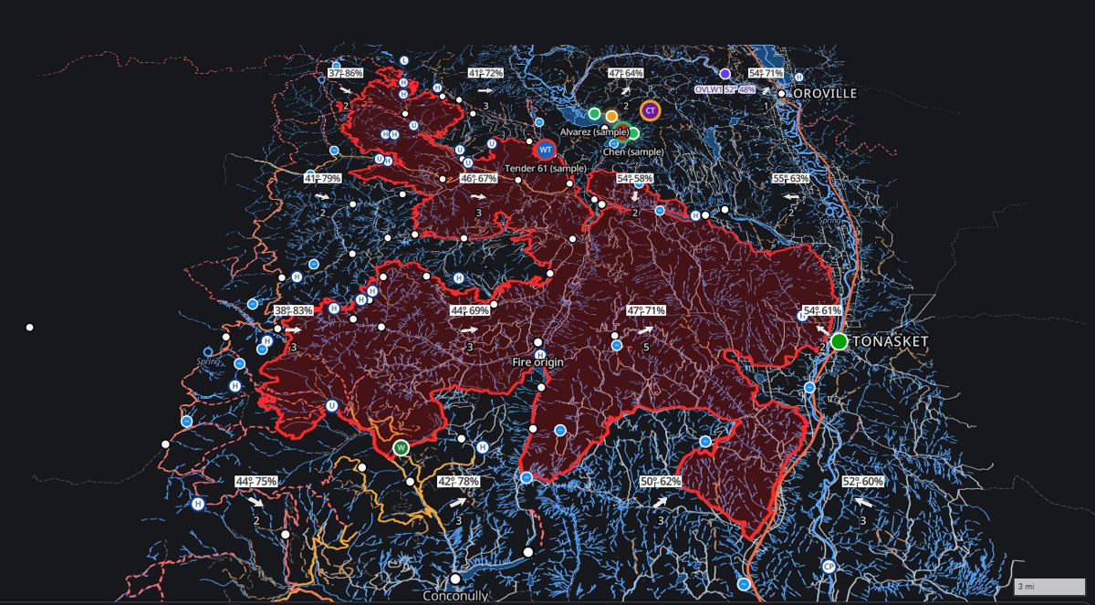
Tactical map of the Sinlahekin fire with perimeter, roads, drop points, and wind
Sinlahekin sample incident pack

Crew tracking that survives no signal

Crew members opt in for an assignment with a join code from command. Positions are recorded on command’s cadence and wait on the phone when there is no link, then send the moment one returns. Command sees who has dropped off and where they were last.

  • Rest, stop, and demob from the phone or from command
  • Accuracy, battery, and link reported with every fix
  • Data stays with the incident and is deleted on its schedule

Emergency alerts, briefings, and messaging

Hold the emergency button and command gets a banner with your position and the link it came over. Command pushes the daily briefing and sees who has it and who acknowledged it. Crews, individuals, and command message each other, and messages wait for signal instead of failing.

  • Acknowledgement tracking with one-tap reminders
  • Crew channels, a private line to command, direct messages
  • Messages are kept with the incident record and are not private

A command board that plugs into your COP

Live positions, trails, accuracy rings, and dropped-off status on topo or imagery, filtered by crew or resource type. Share a revocable read-only feed with the tools you already run, and replay any window from the last 14 days for an after-action review.

  • Cursor-on-Target for TAK and WFTAK
  • KML for ATAK and Google Earth, GeoJSON for ArcGIS
  • Audit log of joins, alerts, acknowledgements, and feeds

Run it on your next assignment

Open an incident, read out the join code at briefing, and watch the board fill in. Agencies interested in a pilot can write to us.

Why it exists

Built on the line, not in a boardroom.

SpikeCamp is built in Oroville, Washington, by an active wildland firefighter and former US Army field artillery officer, after working the 2026 Sinlahekin Fire. Every feature starts from something that went wrong out there: lost crews, dead phones, heavy map files, and long stretches with no signal.

Pricing

Pro is $24.99/year ($2.08/mo). Crew is $99/seat/year. Safety alerts stay free.

Safety info is always free. Billed yearly. Cancel anytime.

Free

$0

Safety info is always free.

  • National fire map
  • A page for each fire
  • Evacuation zones stay free
  • Share any fire page
  • Watch one place free
Start free

Most popular

Pro

$2.08/mo

$24.99/year

  • Watch all your places
  • Aircraft near a place (coming soon)
  • Wind and weather layers
  • Pins with photos
  • One link for family
  • Extra offline map areas (coming soon)
  • Live tactical field maps
  • GPS on the tactical map
  • Meshtastic mesh kit (coming soon)
  • Heart-rate strap and manual log
Unlock Pro $2.08/mo

Crew

$99/seat/year

Everything in Pro, per seat.

Everything in Pro, plus:

  • Radio scanner audio (coming soon)
  • Land ownership colors
  • Fuel layers on the map (coming soon)
  • A fire spread model (coming soon)
  • Crew export files (coming soon)

Crew tracking, emergency alerts, briefings, messaging, and TAK, KML, and GeoJSON feeds are open to every signed-in crew during the pilot. Meshtastic relay is in field testing. How crew tracking works.

Unlock Crew